

Sithean na Raplaich [Sidhean na Raplaich]
Good walks are even better shared.
Overview
Sithean na Raplaich [Sidhean na Raplaich]
Introduction
Nestled in the stunning Scottish Highlands, Sithean na Raplaich beckons hikers with its moderate challenges and breathtaking views. Standing at 718 meters, it is not the tallest of mountains, but what it lacks in height, it more than makes up for with scenic splendor.
Geology
The geology of Sithean na Raplaich is an interesting topic for any outdoors enthusiast. Mostly comprised of sandstone and granite, the rock formations are weathered, providing secret hiding spots for various flora and fauna. Lichens blanket the rocks, creating a patchwork of colours that delight hikers.
Routes
There are two primary routes to reach the summit. The Glen Etive Approach starts at the Glen Etive car park and offers a well-maintained track that’s ideal for both novice and seasoned hikers. The Kingshouse Route begins from the Kingshouse Hotel, allowing adventurers to bask in picturesque views throughout.
Summit Features
Once you reach the top, you’ll find a sturdy cairn and be treated to views that stretch for miles. Whether it's the towering peaks of Ben Starav or the tranquil waters of Loch Etive, your camera will definitely appreciate coming along for the ride.
Terrain
Expect a delightful mix of rocky and grassy terrains, with the occasional boggy patch to navigate through. Make sure you wear supportive boots unless you fancy a dance with the mud!
Hazards
The wonder of the Highlands comes with its own set of challenges. Weather can change on a dime, and it’s wise to keep an eye on any loose rocks while at the summit. Safety should always be a top priority.
Access
To access Sithean na Raplaich, you can park at the Glen Etive car park which is often bustling with other outdoor enthusiasts. Consider carpooling or planning your visit during the quieter off-peak times to secure a sporty parking spot. Public transport options are sparse, making a vehicle a more sensible choice.
Facilities
Before or after your adventure, swing by the Kingshouse Hotel for some well-earned refreshments. They provide food, drinks, and a warm welcome, not to mention toilets for those inevitable nature calls!
History
The name is steeped in lore. Translated to 'Hill of the Sprites', one can only imagine the stories whispered among the gales. This mountain has captivated the hearts of locals and visitors alike, making it a cornerstone of the area’s cultural fabric.
Conclusion
Sithean na Raplaich is approachable, picturesque, and steeped in history. It’s a must-visit for any hiker wanting to experience the beauty of the Scottish Highlands. Whether you seek solitude, adventure, or a bit of both, this hill is calling your name!
Explore routes near Sithean na Raplaich [Sidhean na Raplaich]
Public walks starting within 80 km of this hill. Nearby does not mean a route reaches the summit; check its map and access before setting out.
Ben Nevis via Mountain Path
View route
Banavie to Glen Loy Aqueduct: Neptune’s Staircase Canal Towpath
View route
Crinan Canal: Bellanoch and Dunardry towpath return
View route
West Highland Way: Tyndrum to Bridge of Orchy
View route
Route planning notes
These notes describe possible approaches, not verified navigable routes or permission to cross land. Check current paths, local access rules and conditions before setting out.
Glen Etive Approach
A popular route that begins at the Glen Etive car park. Follow the well-trodden track alongside the river before ascending to the summit. A rewarding hike for both beginners and seasoned walkers.
Kingshouse Route
Starting from the iconic Kingshouse Hotel, this path allows hikers to enjoy scenic views of the surrounding mountains while making their way to Sithean na Raplaich. A delightful day's adventure!
Make a day of it, together
Find someone to share the walk with, or organise a day out along a route you like.
Photo Gallery
View all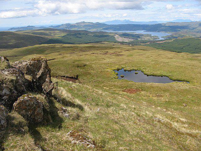 Photo could not load
NM6351 : Sìthean na Raplaich
Richard Webb
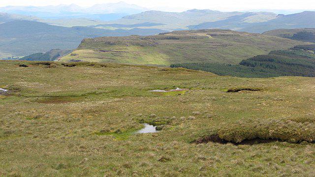 Photo could not load
NM6351 : Sìthean na Raplaich
Richard Webb
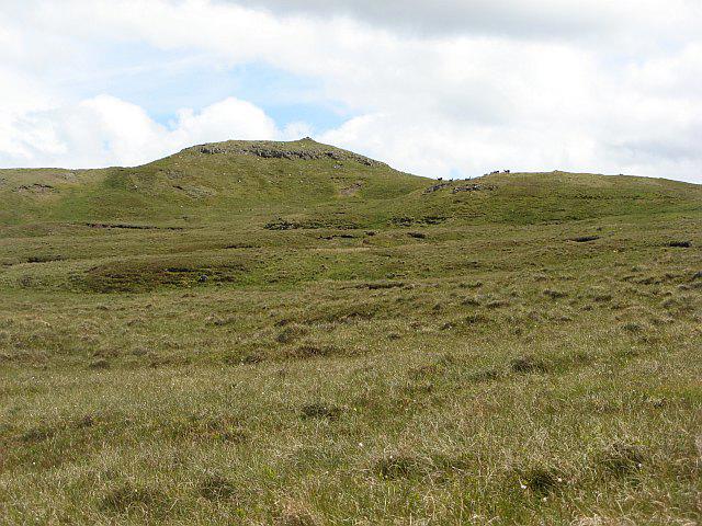 Photo could not load
NM6351 : Sìthean na Raplaich
Richard Webb
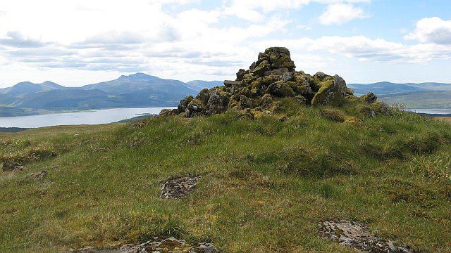 Photo could not load
NM6351 : Summit, Sìthean na Raplaich
Richard Webb
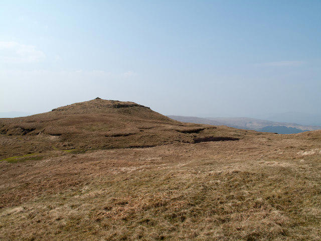 Photo could not load
NM6351 : Summit of Sìthean na Raplaich
Trevor Littlewood
Hill facts and local notes
Classifications
Elevation
551m
1,808 ft
Prominence
523m
Coordinates
56.5973, -5.8525
NM636516
OS Map
49
Explorer: 383W
At the Summit
The summit features a prominent cairn and offers panoramic views of the surrounding Highlands, including the majestic Ben Starav and the stunning glens below.
Terrain & Geology
The mountain is primarily composed of sandstone and granite, presenting some stunning weathered rock formations that can catch the eye of any geology enthusiast. The colourful lichens that adorn the rocks add to its charm, providing a beautiful contrast against the stark landscape.
Views & Scenery
From the summit, you can see the stunning peaks of the Glencoe mountain range to the north and the expansive Loch Etive to the west. Your camera will thank you!
History & Heritage
Name Origin
The name 'Sithean na Raplaich' translates to 'Hill of the Sprites', perhaps hinting at the mystical tales that abound in Scottish folklore.
Historical Significance
This mountain has been a part of local history and culture, often featured in stories passed down through generations.
Getting There & Facilities
Check current local access restrictions, parking rules and transport timetables before travelling. These notes do not confirm public access to the summit.
Parking
There is a small car park at Glen Etive (NM 198 497), but it can get quite full during peak season. Arrive early to secure a spot!
Public Transport
Limited public transport options are available; the nearest bus stops are in nearby towns, so a car is recommended for access.
Nearby Facilities
The Kingshouse Hotel provides food, drink, and toilet facilities, making it a perfect start or end point for your hike.
Safety Information
Known Hazards
- Be aware of sudden weather changes; conditions can deteriorate quickly in the Highlands. Keep an eye out for loose rocks while navigating the summit area.
General Safety Tips
- Check weather conditions before setting out
- Carry appropriate clothing and equipment
- Let someone know your planned route
- Take a map, compass, and GPS device
- Carry emergency supplies: food, water, first aid kit, torch
Hills
Some common questions about the hills answered
Are there group walks up Sithean na Raplaich [Sidhean na Raplaich]?
Many walkers use Walkmates to join or organise walks with others. You can check for group walks around Sithean na Raplaich [Sidhean na Raplaich] through the maps
Are there other walkers around Sithean na Raplaich [Sidhean na Raplaich]?
Activity varies by location and time, but Walkmates lets you see whether others have shared walks or shown interest in this area. Find other people through the walking friends search walking friends for Sithean na Raplaich [Sidhean na Raplaich] search or of course create your own walk for Sithean na Raplaich [Sidhean na Raplaich]
Can I organise a walk to Sithean na Raplaich [Sidhean na Raplaich]?
Yes. If there aren’t any walks listed already, you can create a walk and make it available for others to join.
If you're signed up to Walkmates, you can create a walk to Sithean na Raplaich [Sidhean na Raplaich].
How do I find a walk up this hill?
There are often multiple ways to walk this hill, depending on experience and route preference. Walkmates helps you explore walks and routes that others have shared.
Can I suggest a new route up Sithean na Raplaich [Sidhean na Raplaich]?
Yes. You can suggest or create routes to share with others. Walkmates focuses on the social side of walking, so routes are used to help people organise walks and explore areas together, rather than as detailed navigation tools or route libraries.
Other uses really appreciate knowledgeable walkers sharing their routes. Share your favourite route to Sithean na Raplaich [Sidhean na Raplaich] here
The is an error or something incorrect about this hill. How do I let you know?
We always strive to keep the information on Walkmates as accurate as possible. If you find an error, please let us know through the contact form and we'll aim to correct it as quickly as possible
Community Discussion
Comments
Location
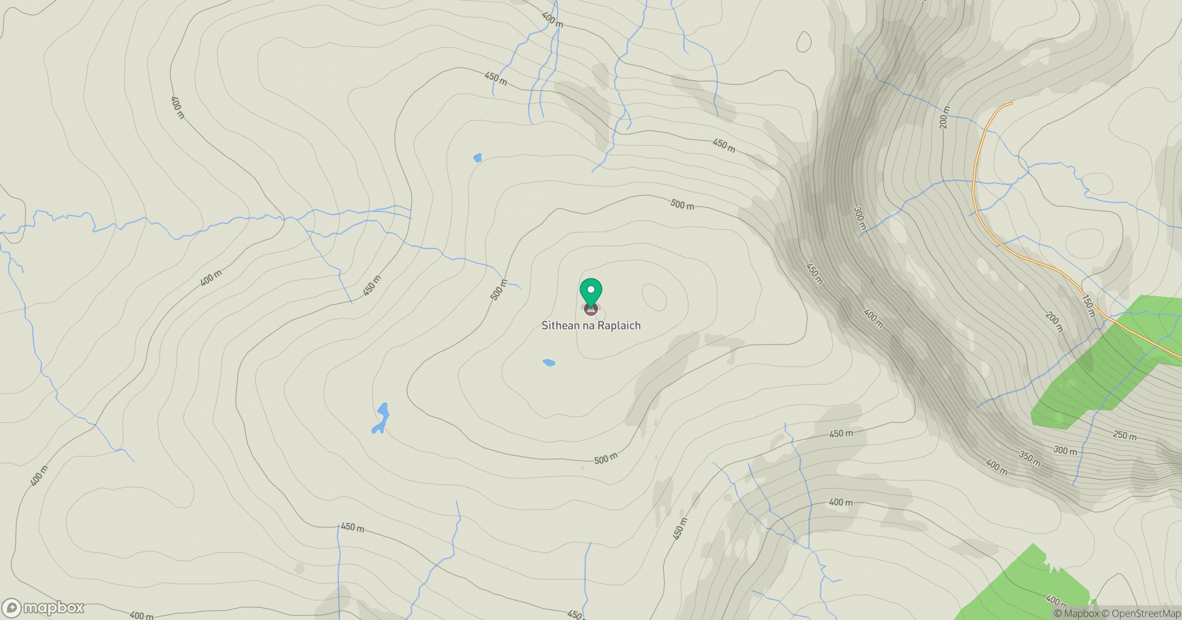
Grid reference: NM636516
View on OpenStreetMapOpens a map in a new tab, centred on the hill.
Hills within 30 km
Straight-line distance, not a walking route or confirmation of access.
No comments yet. Be the first.